Wednesday, November 23, 2011
9:23 A.M.

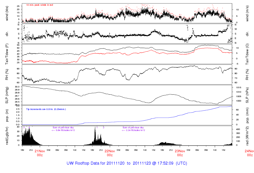
The Pacific Northwest has seen incredible amounts of rain over the last 48 hours. A stationary front stalled over our region and directed relatively warm, moist air over our region, giving us heavy rain and strong winds, especially further south along the Oregon coast. In the lowlands, anywhere from 2-6 inches of rain fell. The Hood Canal area saw the heaviest rain, receiving up to 6 inches in spots from this storm. Even the UW campus has see around 2.5 inches of rain in the last 48 hours.
One of the most fascinating aspects of this storm was how we could see it on the coastal radar. Remember how I talked about that “thin band of heavy rain”? Check this image out.

11:25 pm PST Tue 22 Nov 2011 – Langley Hill Radar
If you look off the coast, you can see a very heavy band of precipitation off the Washington coast stretching into the Olympic Peninsula. This band actually stalled over this area for around 2 hours last night. If this happened in Seattle, catastrophic flooding would have resulted. The last time something like this happened in Seattle was between 4 and 5 P.M. on December 14, 2006, where Seattle received around an inch of rain in one hour.
Seattle has seen some urban flooding, but the rivers have seen more. Although this wasn’t a major flooding event for the rivers, as snow levels didn’t rise super high, some rivers did see some flooding. Most of these rivers are still rising, and the graphic below shows their expected crests. The Skokomish River is expected to experience major flooding, and the Stillaguamish will experience moderate flooding. The Chehalis, at this point, looks to only experience minor flooding, as less rain fell than forecast over the Olympics. If snow levels were higher with this storm, I’m sure that most rivers in Western Washington would experience flooding, with several getting to major flood stage.

Another big aspect of this storm was the wind it brought to the Oregon Coast. It was breezy here, but the Oregon Coast experienced some scarily strong winds. The model below is from last night and shows the expected winds at 1 A.M. this past morning. The winds have since died down, but they are still strong from the central Oregon coast southward.

Valid 01:00 am PST Wed, 23 Nov 2011 – 9hr Fcst – UW 00z 12km WRF-GFS 10m wind speed, SLP
50 knots sustained! That is approaching hurricane force, and there were certainly hurricane-force gusts. I’ll get the highest gusts from this storm later when I can find them online.
On Thursday, we’ll have to deal with another batch of heavy rain, wind, and mountain snow. This system will be weaker than the last one and will move by much more quickly, but it will still be a big November storm and will give us some pretty gnarly weather.
The latest model run shows some very strong winds for the coast, with sustained winds reaching 45 knots. The north interior will also get blasted as well. A storm warning is in effect for the coast, and the north interior has a storm watch. We’ll have to watch the next model runs closely.

Valid 01:00 pm PST Thu, 24 Nov 2011 – 33hr Fcst – UW 12z 4km WRF-GFS 10m wind speed, SLP
For travelers, the biggest problem this storm will pose is a threat of significant mountain snow.

Valid 04:00 am PST Fri, 25 Nov 2011 – 48hr Fcst – UW 12z 4km WRF-GFS 24-hour snowfall
The snow level will be around 2,000 feet, and models are showing up to a foot of snow in places. I would not be surprised if these amounts turned out to be higher though.
Class in 3 minutes, gotta go!
Charlie
