Wednesday, February 17, 2016
6:15 pm
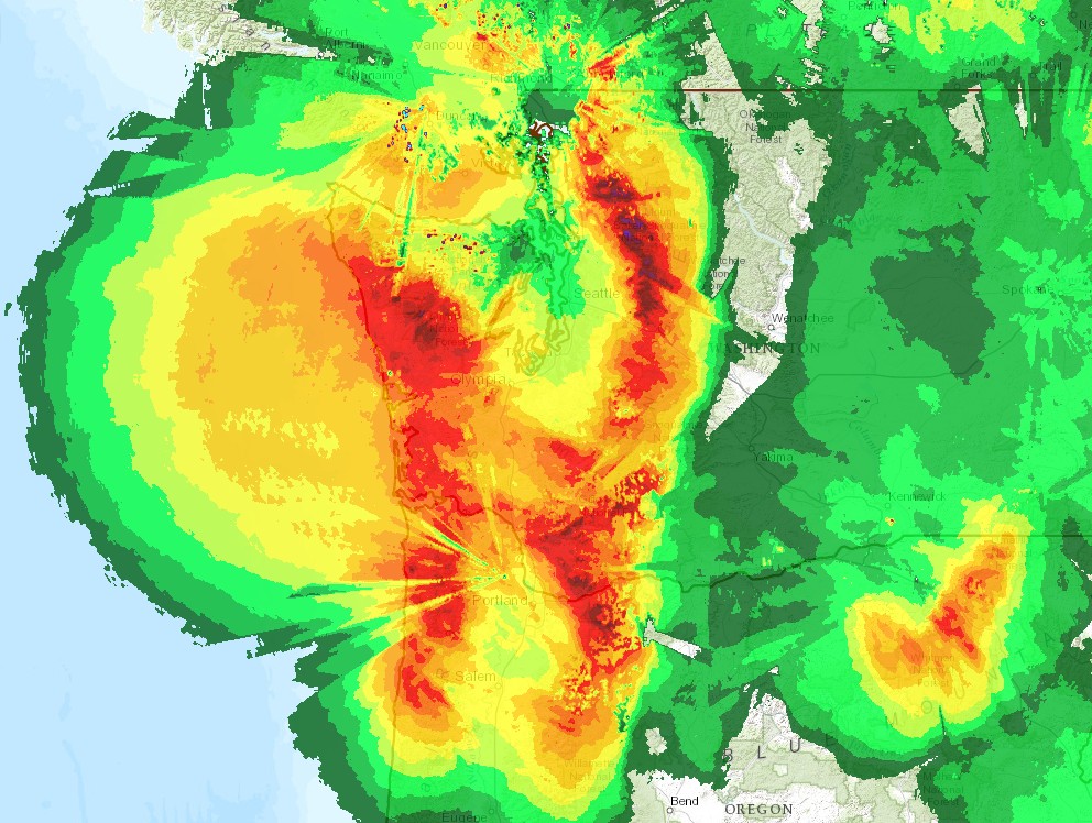
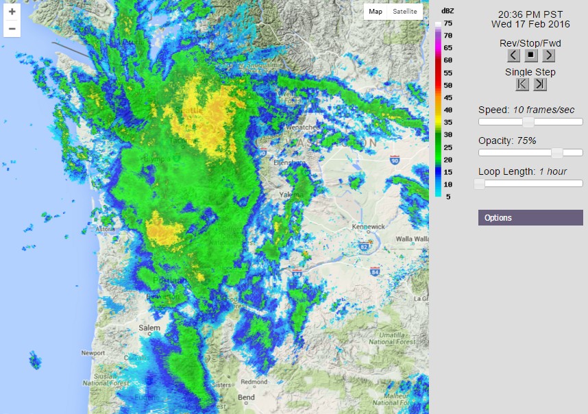
It was a bad week for the snow-lovers of the Pacific Northwest. Over the past couple days, we’ve had very moist and relatively mild flow coming into our region from the WSW. The result? Heavy rains on the Olympics and Northern Cascades, with much lighter precipitation in the Seattle area due to rainshadowing by the Olympics. These “atmospheric rivers” are really good for showing how much our topography affects our weather around the region. Take a look at some radar-estimated precipitation totals from the storm and compare them a topographical map of the Pacific Northwest. Notice any similarities?
 |
| Credit: National Weather Service |
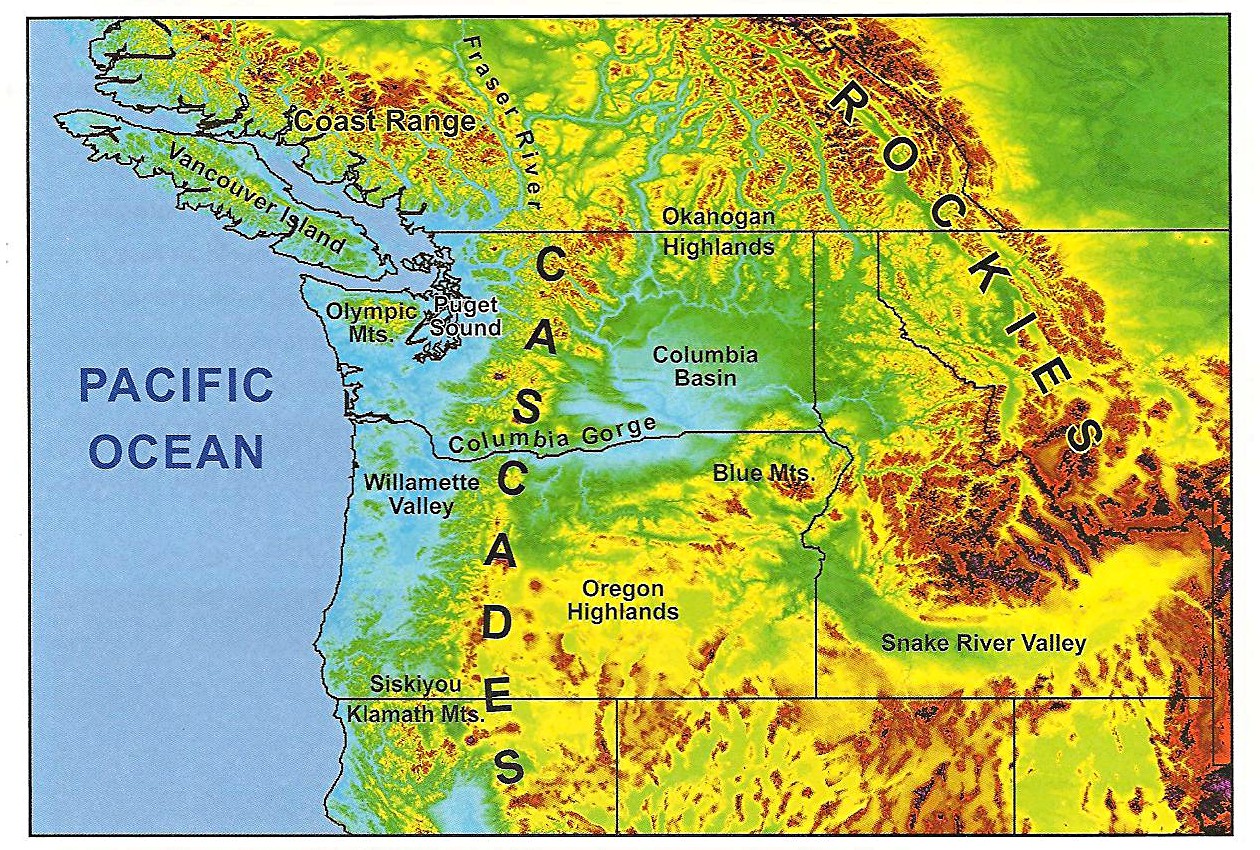 |
| Credit: University of Washington |
There’s clearly more precipitation on windward slopes and less on leeward slopes, with 3-4 inches in some places on the windward slopes of the central and northern Washington Cascades and nothing on the eastern slopes. Amazing! You can even see an increase in precipitation due to the Blue Mountains in Northeast Oregon.
One more graphic… look how much topography affects annual rainfall around the state. It’s just another thing that makes forecasting the weather around here so much fun!
 |
| Credit: Chris Daly and Mike Halblelb of the Oregon State University PRISM group Retrieved from University of Washington |
You can get 200+ inches of precipitation on the highest peaks of the Olympics, but Sequim, on the northeastern part of the Olympic Peninsula, only gets around 16 inches of rain a year – nearly the same amount as Los Angeles. Heck, Sequim is even home to the “Brittle Prickly Pear” cactus – the only cactus native to Western Washington. You won’t find any of those in the Hoh Rainforest!
The good news for snow-lovers is that more snow is on the way. It’s raining at the passes right now, but snow levels, currently at 6,000 feet, will continue to drop as the week goes on. By noon Thursday, the white stuff should finally be falling again at Snoqualmie Pass.
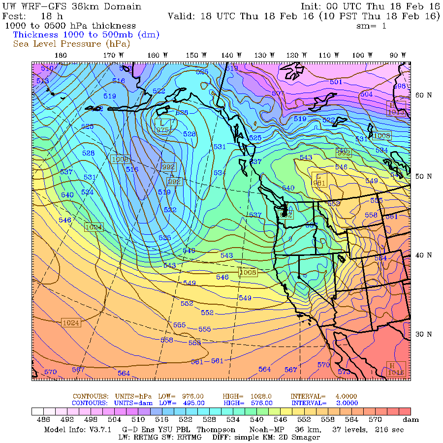
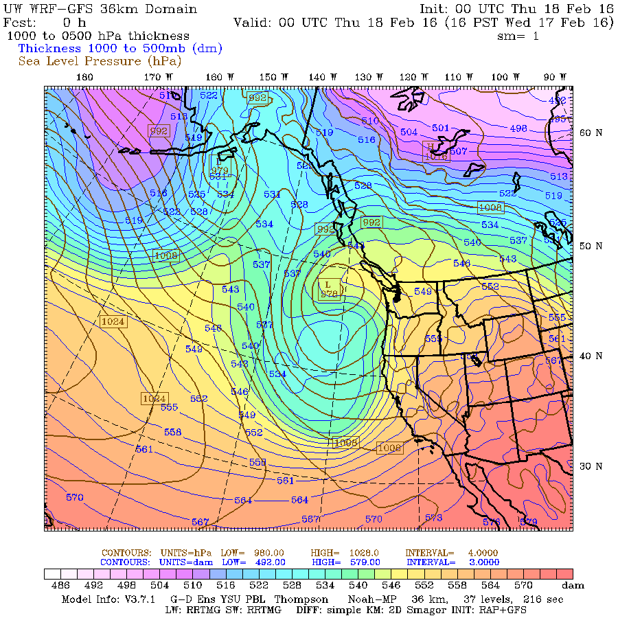 |
| Valid 04:00 pm PST, Wed 17 Feb 2016 Credit: University of Washington Atmospheric Sciences |
The graphic above shows the “thickness” of the atmosphere between the 1000 and 500 hPa pressure levels. Warm air is less dense, so the higher the thickness, the warmer the air throughout that column. Units are in “dam,” which stands for decameters (tens of meters). You can see how although we have relatively low heights associated with a cooler air mass and lower snow levels offshore, the counterclockwise flow around the low is still pumping relatively warm, moist air into our region. As a result, we are seeing warm temperatures and heavy rain in many regions right now.
 |
| Credit: University of Washington Atmospheric Sciences |
However, by tomorrow morning, thicknesses have dropped by nearly 150 meters.
 |
| Valid 10:00 am PST, Thu 18 Feb 2016 – 18hr Fcst Credit: University of Washington Atmospheric Sciences |
Now the graphic everybody cares about: 24-hour snow accumulation.
 |
| Valid 04:00 pm PST, Thu 18 Feb 2016 – 24hr Fcst Credit: University of Washington Atmospheric Sciences |
We finally get some snow here, but areas further south get pummeled with the white stuff. The Sierra Nevada gets feet rather than inches. The Sierra Nevada are very tall mountains that rise dramatically from the Central Valley, so they are very efficient at wringing out moisture. If we had the Sierra Nevada and California had the relatively short Cascades, then skiers, farmers, and utility companies here would be in 7th heaven and California would be in a whole lot more trouble than they are now.
Over the next 24 hours, the focus of the snow shifts north and snow levels plummet below 2,000 feet.
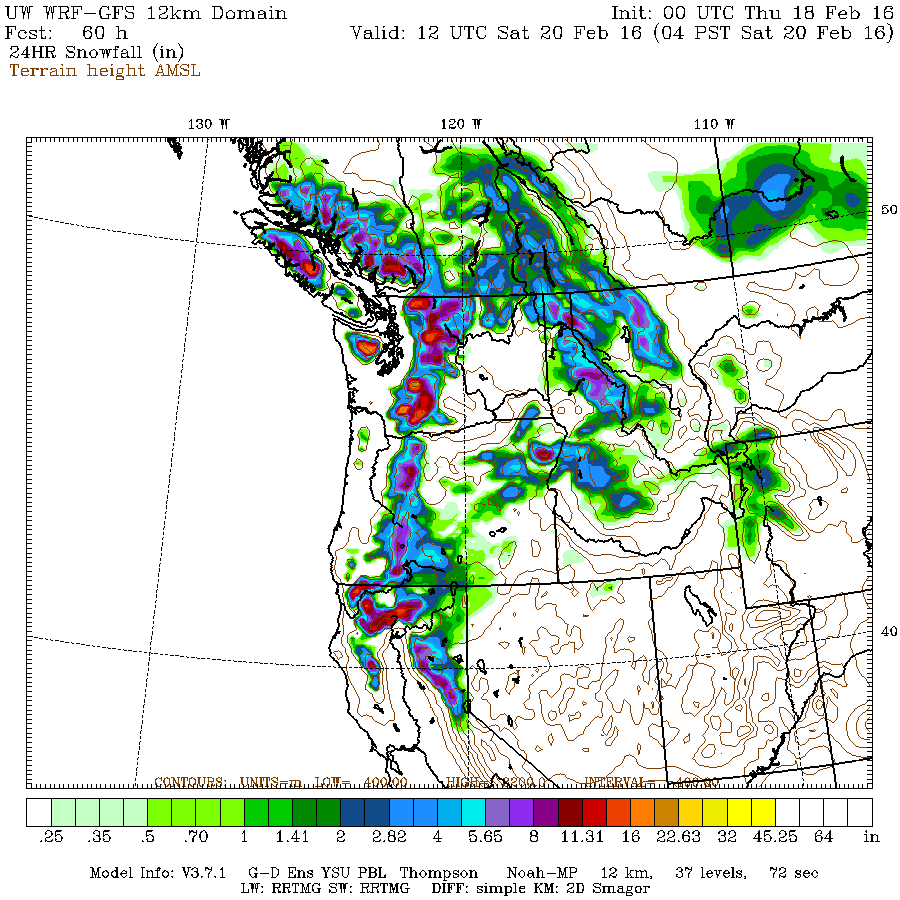 |
| Valid 04:00 am PST, Sat 20 Feb 2016 – 60hr Fcst Credit: University of Washington Atmospheric Sciences |
Skiing should be fantastic this weekend. Saturday in particular should be spectacular, with snowfall decreasing throughout the day. Another system comes in Sunday afternoon, but once again, this one should bring more snow than rain to the Cascades, at least at all the major passes.
Hit the slopes this weekend!
Charlie
1 Comment