
Everything seemed right for record high temperatures at Portland. We had offshore winds to prevent any cooling from the Pacific Ocean and a massive ridge overhead with insanely warm temperatures aloft. But with extreme heat comes extreme fire danger, and fires have erupted over the Pacific Northwest and British Columbia over the past few days.

Image taken by MODIS sensor aboard NASA’s AQUA satellite
Smoke from these fires decreases the amount of solar radiation that can reach the surface. Solar radiation is expressed as units of power per unit area (where power is energy/time), so the less power that reaches the surface, the less energy it receives over the period of a day, and the less it heats up.
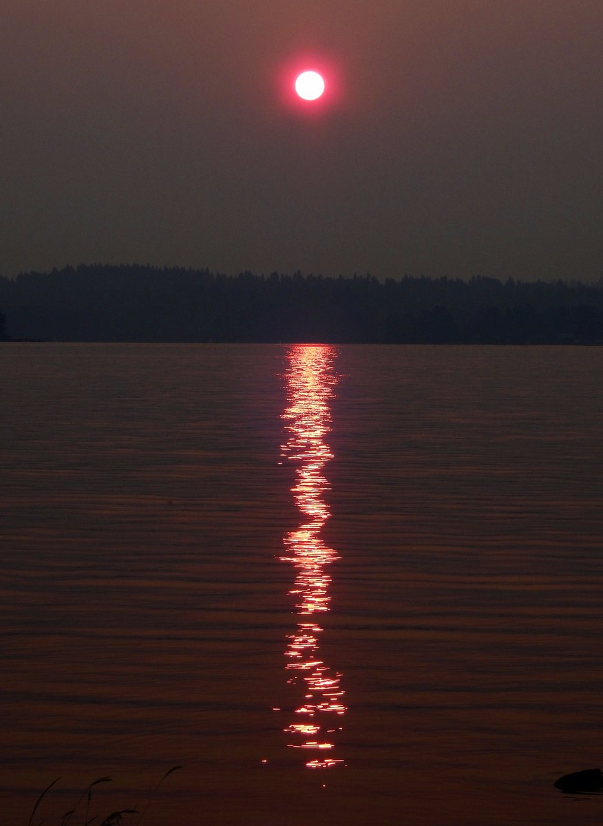
The smoke has made for some eerie sunrises and sunsets. Take a look at this morning’s sunrise from the Seattle NWS office looking over Lake Washington.

Credit: Seattle NWS
The smoke was even thick enough to see sunspot AR2670 WITHOUT A FILTER on the camera!

Credit: Seattle NWS
Here’s a timelapse of yesterday morning’s sunrise from Greg Johnson over at Skunk Bay Weather.
The UW atmospheric sciences building has a instrument to measure solar radiation. Notice how the solar radiation has decreased each day. The increase in smoke increases the “optical depth” of the atmosphere, meaning the atmosphere is less transparent to incoming solar radiation. If you are interested, more information on optical depth can be found on Jeff Haby’s wonderful The Weather Prediction website.

Credit: UW Atmospheric Sciences
Today’s Temperatures:
Though we are no longer expecting to break the all-time record of 107 degrees at Portland, it will still be a scorcher. High temperatures should be similar to yesterday, meaning we’ll have widespread temperatures in the low 100s for the metro area, hotter further south and cooler further north. We cool off slightly tomorrow as the flow switches to weakly onshore, but temperatures should still be in the mid 90s.
Air Quality:
Unfortunately, air quality will remain poor through the weekend and through the majority of next week. Hot/dry conditions will persist through the weekend, and next week looks like another scorcher as a ridge builds overhead, prolonging our high/extreme fire danger. Forecasts currently have this ridge finally moving to the east next weekend, but they have not been consistent with timing, and confidence that far out is lower than normal.
There’s no getting around the fact that this weather sucks, but I hope you can all at least take some interest in these uncommonly high temperatures. In the meantime, do some rain dances and send our firefighters your thanks, they are putting their lives on the line to protect our communities and ecosystems.
~ Charlie


