I’ve always said that there are far more snow days forecast for the Pacific Northwest than appear in reality. There are a few reasons for this. The first is that there are multiple weather models, running multiple times a day, that show nearly every possible weather solution under the sun over the course of the winter. Naturally, snow fans in the Pacific Northwest (myself included!) tend to follow those more “extreme” model solutions more closely, with the hope of sledding and skiing in the city for a week!
But second, and more specifically for the Northwest, it is extremely hard to get arctic air to actually filter into Western Washington and Oregon. Cold air is denser than warm air, and as such, it is channeled by terrain. As such, the “polar vortex” responsible for these arctic outbreaks has to be aimed directly at Western Washington; too far east and the cold air will stay east of the Cascades, and too far west and it will be moderated over the Pacific Ocean. Compare this to the Great Plains or Midwest, which do not have any mountains channeling this frigid, dense air and are not adjacent to a relatively balmy ocean.
Credit: University of Washington
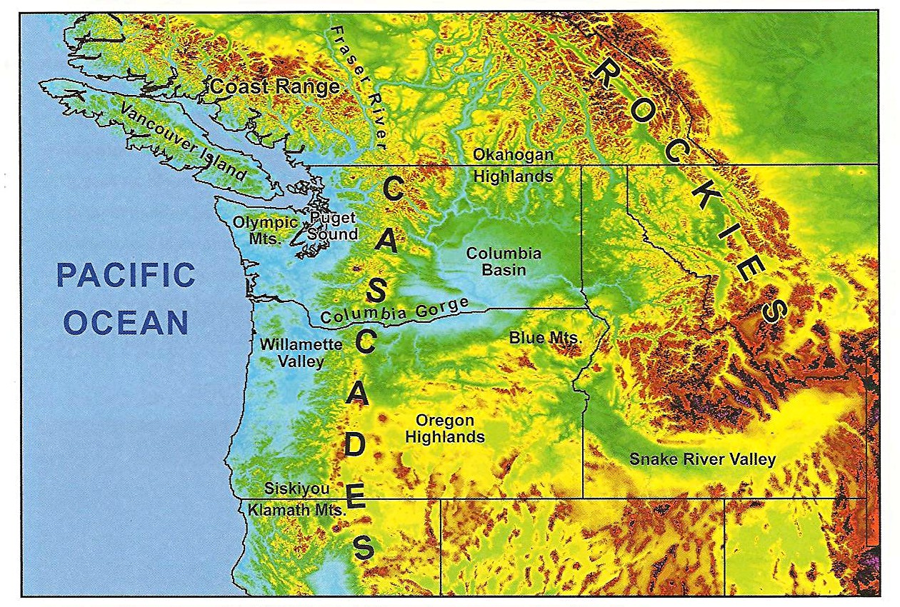
Additionally, even if the polar vortex is *perfectly* positioned to give the I-5 corridor a major arctic blast, the terrain from our north and east helps moderate the cold air before it gets here. Cold air first has to filter through small gaps in the Rockies to get into Interior BC and the Columbia Basin, and then it has to filter through two small passageways – the Fraser River Valley in British Columbia and the Columbia River Gorge along the WA/OR border – to make it into Western Washington and Oregon. By this time, only a fraction of the original arctic airmass has made it into the I-5 corridor. Furthermore, it has decreased in elevation throughout its journey and experienced downslope warming in the process. Nevertheless, a good, well-positioned December arctic blast is usually cold enough for a hard freeze across Western Washington, and – if moisture is present – sea-level-snow.
Such a blast is forecast this week. Before I go into the details, here are some highlights.
Highlights:
- On Sunday night, a deep trough currently centered over Eastern British Columbia will bring extremely cold air to the Northern Rockies and Columbia Basin, with Western Washington receiving a glancing blow. Cold temperatures will last through Tuesday.
- Beginning Tuesday night, a much colder, reinforcing shot of arctic air will bring bone-chilling temps to the Northern Rockies and Interior Northwest. Although the Pacific Northwest will once again see a glancing blow, this airmass is cold enough to potentially bring subfreezing highs to Seattle Wednesday and/or Thursday.
- Models show two potential snow events: one on Tuesday as a quick-hitting system from the Northwest moves into Western Washington, and one on Thursday/early Friday as a mild Pacific frontal system overruns frigid arctic air already in place. The Thursday/early Friday system carries a risk of freezing rain for the Portland metro area and Columbia River Gorge.
- Western Washington/Oregon should transition to a milder pattern by the weekend, but cold air will remain in place over the Columbia Basin until after Christmas and could complicate travel across the Cascade passes ahead of and during the holiday. By next week, the snow threat will be a distant memory and our attention will shift to rain, wind, and rising river levels.
Sunday night – Tuesday: The Initial Arctic Blast and First Snow Threat
The Pacific Northwest is currently experiencing chilly, NW flow, with frigid arctic air bottled north of the border. The 500mb chart below shows this arctic trough, or “polar vortex,” stalled right over Southern BC/Alberta.

Credit: pivotalweather.com
The ridging off the Oregon Coast is preventing this trough from moving directly into the Pacific Northwest. However, cold air at the surface will still begin to filter into the Columbia Basin and Western Washington tonight and into tomorrow as an “arctic front” forms along the leading edge of this trough and slowly moves south. Check out the temps at 7am tomorrow morning… frigid in BC/Alberta, and much colder for Bellingham than Portland.

Credit: University of Washington
Tuesday will be slightly milder for the Westside as the polar vortex shifts east, but Eastern Washington will turn even colder, and Alberta will be in a deep freeze.

Credit: University of Washington
Additionally, note the extreme offshore pressure gradients due to the frigid air inland and the comparatively mild air east of the Cascades. This means that the favored locations for gap flow, such as the Western Columbia River Gorge, Cascade foothill locations like Enumclaw or North Bend, and the Northern Interior of Washington will see intense, bitterly cold offshore winds. Crown Point, about 30 miles east of Portland, is notorious for strong winds in these scenarios. I suspect both the TV crews and the weather geeks will be out in full force this week.
Tuesday Snow
Some places around the Sound saw a few snow flurries this afternoon and evening. However, our first real threat of impactful, sticking snow this week is on Tuesday as a quick-hitting system arrives from the NW. Precipitation amounts are highly uncertain – some models give Seattle up to 5 inches of snow, while others give just a trace. The ensemble mean gives Seattle approximately 2-3 inches of snow on Tuesday, while areas over the south sound get very little and areas further north get closer to 4-5 inches. Any snow that does fall will stick to the roads and create treacherous travel conditions, so plan accordingly.

Wednesday – Friday: The Reinforcing Arctic Blast and Portland Freezing Rain Threat
On Wednesday, a reinforcing shot of arctic air will move south, and on Thursday and into Friday morning, a mild storm will approach from the Pacific. This could result in a messy “overrunning” event where moist, Pacific air moves over cold, subfreezing air, with a few inches of snow over Western Washington and a nasty mix of snow, sleet, freezing rain, and extremely strong easterly winds near the Portland metro.
If you thought the pressure gradients were strong with Tuesday night’s map above, take a look at the expected gradients midday Thursday! This is due to much colder air and much higher surface pressures east of the Cascades. Again, note how this arctic outbreak clips Western Washington and NW Oregon, but the brunt of the outbreak is further inland. Crown Point could see triple-digit gusts in this.

Credit: University of Washington
While this cold air remains in place, a frontal system should approach from the west on Thursday and spread precipitation over the area.

Credit: University of Washington

Current ensembles show this storm bringing less snow to the Seattle area, but some show up to a half inch of freezing rain in the Western Columbia River Gorge. While the Gorge is no stranger to freezing rain, 0.5″ would be enough to cause damage to limbs and power lines, particularly with the howling east winds expected through the Gorge into Portland.
Temperatures Wednesday and Thursday may only top out in the mid-upper 20s across Western Washington and Oregon – significantly colder than either Monday or Tuesday. The cold air should finally depart Western Washington on Friday, and the weekend may feature highs near 50 and rainy/windy conditions as southwest flow returns to the Pacific Northwest. Friday/Saturday travel across the passes will likely still be difficult due to stubborn sub-freezing air over the Columbia Basin, but after Christmas, the cold weather should be a faint memory as we enter a wet and windy pattern with a series of storms coming off the Pacific and snow levels rising well above the passes.
Prepare for the cold weather this week and potential snow chances, particularly with the storm during the latter half of the week. And if you check out the wind at Crown Point, dress for success – you just might end up on TV!

