Anybody missing the heat? If so, I’ve got some good news for you!

It’s coming back!
Now, before you start researching air conditioners online, know that this will not be a “heat wave” like the ones we saw to finish off our August. Rather, it will be a “warm wave,” with high temperatures in the 70s and 80s for much of Western Washington. Of course, the details are a bit murky at this time, but I’ll do my best.

Credit: University of Washington Atmospheric Sciences
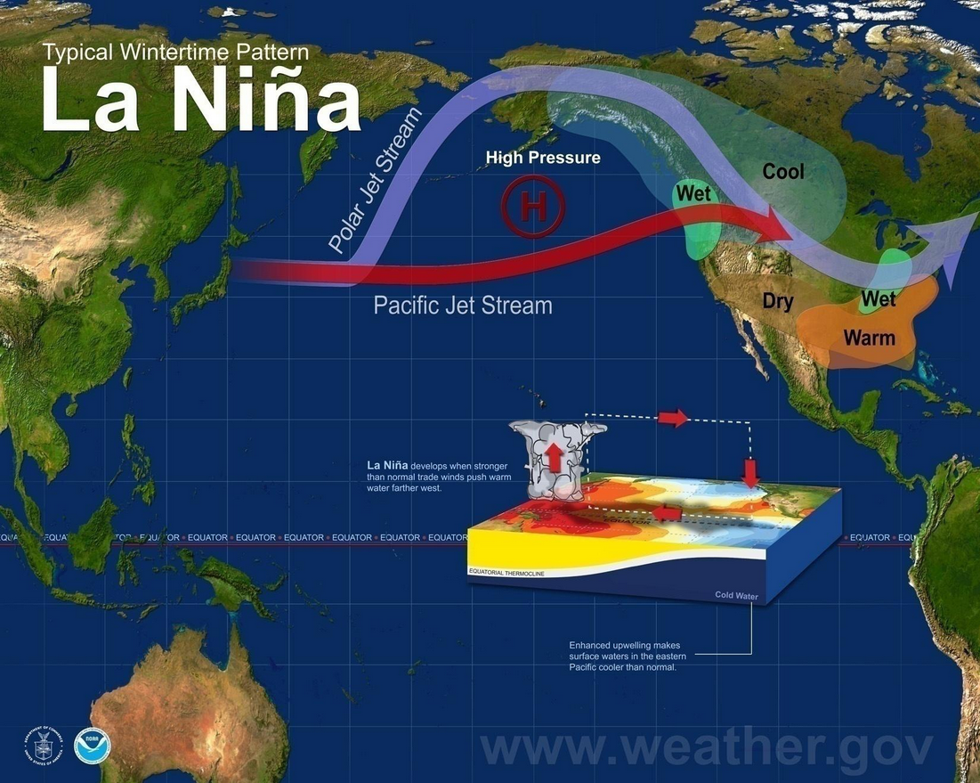
Over the past several days, we’ve seen cooler-than-normal temperatures due to northwesterly flow along the back side of a large ridge of high pressure centered near 150 degrees W. A couple systems have been embedded in this flow, including one that brought a strong Puget Sound convergence zone to North Seattle and points east on Friday, bringing heavy rain (2-3 inches near Monroe!), thunder, and even a funnel cloud. This upper-level setup is actually pretty darn similar to what we’d expect during a La Nina winter, so don’t be surprised if it makes frequent appearances over the next few months.

Credit: NWS/NOAA
As the week goes on, this ridge will flatten and move eastward, opening up the door for zonal flow with weak embedded systems impacting us Monday night, Wednesday night, and Friday/Saturday.

Credit: University of Washington Atmospheric Sciences
After our Saturday system, we finally begin to warm up and dry out as a ridge builds along the West Coast.

Credit: University of Washington Atmospheric Sciences
A lot can change between now and 180 hours out, but I’m pretty confident that sunnier weather is ahead because all major global models are advertising this pattern change and there is relatively little variance in the GFS ensembles posted above. At day 16, only three ensemble members show below-average temperatures at 850 mb (around 5,000 feet). The Climate Prediction Center is also going for above-average temperatures and below-normal precip both for the 6-10 day time frame and the 8-14 day time frame.
 |
 |
We got one more week to go, but sunny weather isn’t too far around the corner!
