October 27, 2010
1:59 P.M.

Look at that storm!!!
Now, many of you may have heard about the huge storm in the Midwest. There has been a lot of talk about it being the strongest extratropical storm on record on the contiguous 48 states. The media generally says it is. However, many of the local weather guys around here say no. Who should you believe? Well, you should believe me, and both sides have valid points.
This storm officially has the lowest pressure ever recorded by an extratropical cyclone on the contiguous 48 states. The mercury bottomed out at 28.20″ (954.9 millibars) in Bigfork, Minnesota yesterday at around 5:13 CDT. This is an official, all time record. Now, note that I respect Cliff Mass very much and regard him as a GOD, but I think he is mistaken when he says that we have had the deepest storms. We have had some very deep storms – the most recent example being a storm from December 12, 1995. According to Wolf Read that storm probably bottomed out at 953 millibars, (see my Storm King website link – he has put together a fantastic website of historical Pacific Northwest) which is deeper than this storm, but by the time it reached land, it was above 955, and I think the lowest actual measured pressure was like 958 mb or something. So that storm is not the deepest storm to hit the continental U.S. There may be a storm back in January 1880 (which has been nicknamed “The Storm King” itself) that may have been deeper, but there is not a real official reading. So the record belongs to Bigfork.
BUT… our windstorms are stronger than theirs by far. Why? Because our storms are more compact and have stronger pressure gradients. Look how big the storm is in that satellite photo. The winds cover a huge area. However, since they cover such a big area, they are also less extreme. The pressure gradients drive the winds, and if the storm is bigger and the pressure gradients are more relaxed, the winds are not going to be as strong. There was an 81 mile-per-hour gust and it made national headlines. That really is not that fast. The coast sees gusts like that every winter, and even Puget Sound gets them sometimes.
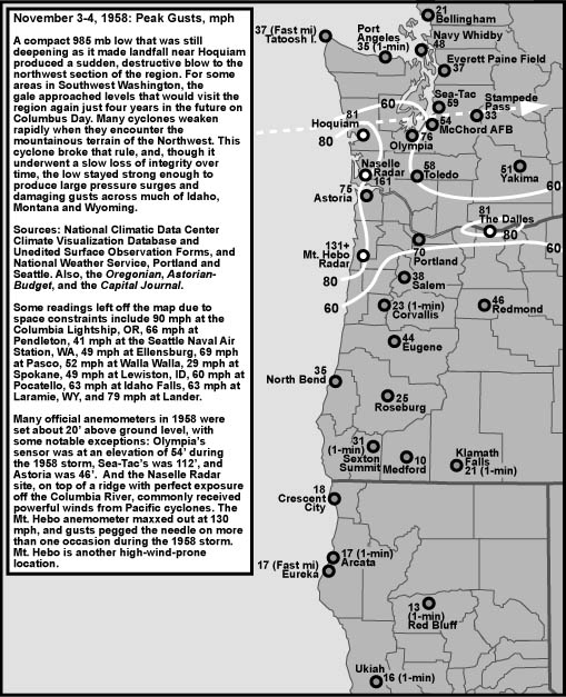
A great example to show how our storms are more compact than the ones over the rest of the nation is our “Intense Cyclone of November 3, 1958.”

This is from Wolf Read’s website. This storm was only 985 mb, yet it produced a 161 mph gust. Contrast that to a 955 mb storm that produced a 81 mph gust. This clearly shows the difference in wind velocity between the two storms. Our wind velocity is higher because this cyclone was much more compact.
But no windstorm can even approach the Columbus Day Storm in terms of wind speeds.

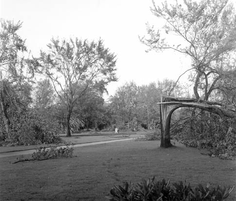
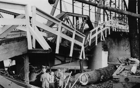
Gusts of 116 in downtown Portland, 127 in Corvallis, 160 at the Naselle Radar site (it commonly gets really windy there), 170 in the Tillamook Forest, 150 SUSTAINED at Cape Blanco with gusts to 179, or they may have been as high as 195, as one of my many weather books estimates. Renton got to 100. Newport got to 138. The list just goes on and on. The “Perfect Storm” of 1991 had a peak gust of 85, and that was at a coastal station. There is a possible 110 mile-per-hour difference in peak wind gusts. So much for the “Perfect Storm!” When you add that on to the fact that the Pacific Northwest has tons of huge, shallow rooted trees to blow down and the Northeast has a lot less, you wonder where that storm got that name in the first place. Here are some Columbus Day photographs to give you an idea of the damage. Everything is from Wolf Read.


There is one thing that those easterners do have on us though in the “who has more gnarly extratropical cyclones” and that is severe thunderstorms. Their cyclones produce severe thunderstorms. This last one produced a little over 20 tornadoes, and although I don’t think any of these tornadoes were huge, there was one storm that produced a huge tornado outbreak. April 3, 1974 was a date that will live in infamy as the largest tornado outbreak ever recorded. And these tornadoes were strong. 315 people died and over 5,000 were injured.
Take a look at this tornado. It hit Xenia, Ohio as an F5 with estimated 300 mph winds and completely decimated the town.

Photo by Fred Stewart, retrieved from Wilmington, Ohio NWS Forecast office
So, the most damaging event was not the Columbus Day Storm or the one that we just saw over the Midwest. It was the “Super Outbreak” of 1974! A great website to learn more about this outbreak is http://www.april31974.com/. When people talk about the strength of extra-tropical cyclones, they are generally talking about wind speed that is associated with the pressure gradients directly. In that case, the Columbus Day Storm outshines everything else by several orders of magnitude. But the Super Outbreak was a horrifically powerful weather event in a different way, and that’s why I am calling it the most destructive extratropical storm the United States has seen in the last 110 years.
Oh yeah… a weather forecast.
We could see flooding next week. Stay tuned…
Charlie Phillips, over and out.

1 Comment
I've read of another pressure record: 28.10 inHg / 952 hPa during a big nor'wester on March 1-2 1914.