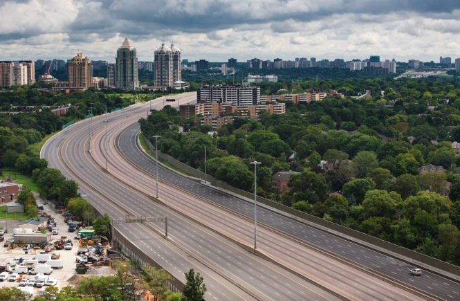
On Friday, Seattle was cut off from the north, the south, and the east due to flooding from the Chehalis River inundating I-5, extreme amounts of snow in the Washington passes, and all roads out of Vancouver BC being closed due to heavy snowfall. None of these individual events are unprecedented – the Chehalis spilled its banks over I-5 during the catastrophic 2007 “Great Coastal Gale,” and WSDOT commonly closes the Cascade passes in the winter to clear snow and do avalanche control. However, I don’t ever remember I-5 and the mountain passes over Washington and BC being all closed at the same time. The only way into Seattle on Friday was to arrive from the coast.
Although the waters have subsided over I-5, all major mountain passes remain closed as of Sunday afternoon, and Stevens pass may be closed until Wednesday. Just look at this picture from WSDOT earlier today!
An example of what we’re dealing with on Stevens Pass today. We continue to be without power or cell service, and have a slab of ice 4 inches thick on the cleared lanes. We’ll need to bring in the sno cat to knock down these slides before the blower can start clearing the rest… pic.twitter.com/qSEFXfGLYh
— WSDOT East (@WSDOT_East) January 9, 2022
And here’s some drone footage showing flooding over Lewis County (I-5 had reopened by this time).
Mother Nature has thrown the proverbial kitchen sink at us over the past two weeks. We saw a record-breaking arctic outbreak to end December followed by a series of intense, chilly systems bringing copious amounts of snow to the mountains in early January, and we capped everything off with a major atmospheric river on January 6 that brought record flooding west of the Cascades and record snowfall east of the Cascades. In this blog, I’ll break down the evolution of the arctic outbreak and subsequent atmospheric river, and I’ll tie everything together to show how this combo resulted in both record flooding and record snowfall at the same time.
Last Week of December: Historic Arctic Outbreak
The last week of December saw one of the largest Pacific Northwest arctic outbreaks of the 21st century, with Seattle reaching its coldest temperatures since November 2010 and experiencing four consecutive days of sub freezing temperatures from Dec 26-29, a longer stretch than November 2010 or even December 2008. The air was even colder north of the BC/US Border, with Vancouver BC experiencing its coldest low since Jan 29th, 1969 and Prince George in Northern BC experiencing an all-time record low of -40.7 C (-41.3 F), breaking a 1933 record of -40 (-40C and -40F are equivalent). It’s also a noteworthy coincidence that this arctic blast occurred exactly 6 months after the record-breaking “Heat Dome” of late June 2021.
Like all of our bona-fide arctic outbreaks, this event was associated with a lobe of the infamous “polar vortex” moving into the Pacific Northwest. Before late December, the jet stream was in a relatively zonal configuration, allowing a stronger-than-average polar vortex to build over the arctic but shielding the Lower 48. When the jet stream became more amplified and a large ridge over the Pacific began to perturb this polar vortex, a lobe of the PV plunged straight towards SW Canada and the Pacific NW.

Credit: University of Washington
There was also a lot of mountain snow in the days preceding the outbreak and during the initial arctic front on 12/26. And although precipitation was less during the latter stages of the arctic outbreak, several weak systems arrived from the northwest, bringing light snow to the lowlands and moderate/heavy, orographically enhanced snow to the mountains. The below table shows the daily snowfall, along with the total snow base and total snow accumulation, at Snoqualmie Pass from 12/23 to 1/9.

Credit: WSDOT
Temperatures in Canada got so cold that the Alberta Electric System Operator (AESO), which is responsible for balancing and operating Alberta’s power grid, declared a “Level 2 Energy Emergency” due to their power generation resources being stretched thin due to record high power loads, a lack of wind, and unplanned generator outages (I’m guessing due to gas plants having trouble starting/operating in extreme cold). AESO’s “Energy Emergency Alert” just meant that AESO was running low on generation resources… there were NOT widespread outages (and nearly a catastrophic failure of the entire grid) like there were in Texas in February 2021. But it goes to show how much these arctic outbreaks can stress our power grid, particularly when power plants or gas infrastructure malfunction due to the extreme cold.
We have declared an Energy Emergency Alert (EEA) Level 2 as of 3:52 p.m.
EEA 2 means we are using reserves to balance the power system. This is due to unplanned generator outages, low wind and a reduction of import capability. Supply is tight but still meeting demand. (1/2) pic.twitter.com/pCcbvwtDCT
— AESO (@theAESO) July 7, 2021
First Week of January: Chilly Storms & Atmospheric River
On the first week of January, this polar vortex shifted to the east, and a broader trough of low pressure formed in the East Pacific, opening up the Pacific Northwest to a strong Pacific jet and a series of chilly, moderate/strong systems arriving from the WNW. This was a classic La Nina pattern, with a strong, blocking ridge in the North Pacific, a downstream trough in the Eastern Pacific, and chilly systems riding along a strong WNW jet into the Pacific NW.

Credit: University of Washington
This general pattern held in place from Jan 2-5, bringing moderate rain to the lowlands and extremely heavy snow to the mountains. This is a favorable pattern for mountain snow due to not only the chilly weather and low snow levels but also the fact that the flow is essentially perpendicular to the Cascades, resulting in extremely efficient orographic (terrain-induced) enhancement of precipitation. And although these systems eroded the truly frigid air over the Pacific Northwest, Central and Eastern Washington remained well-below freezing during the entirety of the event, resulting in additional snow. A particularly strong and slow-moving anafront came through the evening of Jan 2, bringing a surprise snow to parts of the Puget Sound lowlands and a steady, heavy rain to Seattle proper.
But the main event – the atmospheric river that brought the heaviest snow to Eastern WA and major flooding to Western WA, arrived January 6. Over SW Washington, snow levels skyrocketed to 7,000 feet and some locations broke all-time rainfall records for a single day. Hoquiam set a new all-time record with 5.78″ of rain, and some places in the SW Washington Cascades saw storm totals close to 10 inches. Meanwhile, a deep layer of subfreezing air remained entrenched over Eastern Washington, resulting in extreme amounts of snowfall before precipitation finally changed over to rain later on the 6th and 7th. The east slopes of the Cascades were particularly hard hit, with Leavenworth receiving a staggering 36″ of snowfall in 24 hours spanning the 5th and 6th!
Pretty much sums things up … pic.twitter.com/yzJ2Ylqrds
— Seattle Maven 🍳🍹 Ann Peavey (@SeattleMaven) January 7, 2022
Dashing through the snow…well, sort of! 🦌
Phil Shinnick captured these deer trying to make their way through the antler-high snow today in Leavenworth. #WAwx pic.twitter.com/hto5oIgrkZ
— Shannon O’Donnell (@ShannonODKOMO) January 10, 2022
The combination of melting, low-elevation snow and record rainfall caused record flooding on the Skookumchuck and Newakum rivers, both of which are relatively low-lying rivers and saw significant impacts from the melting low-elevation snow. The Chehalis River saw near-record flooding, but most places crested a bit below the values seen in early December 2007, when the “Great Coastal Gale,” arguably the strongest atmospheric river to hit SW WA on record, brought a prolonged period of catastrophic winds to the coast and submerged parts of I-5 under 10 feet of water.
SEW extends time of Flood Warning for Skookumchuck River near Bucoda [WA] till Jan 8, 11:43 PM PST https://t.co/I8aHUJhayM pic.twitter.com/K8gUa7fdBA
— IEMBot SEW (@iembot_sew) January 9, 2022
Forecast
Tuesday and Wednesday morning will be warm and wet as a relatively weak atmospheric river brings 5-7″ of rain to the Olympics and 3-5″ to the Cascades. The lowlands should be in the 1-2″ range, with less in the Olympic Rainshadow. Note that the rainshadow should be a bit further south than usual and could potentially migrate all the way south to Seattle Tuesday evening.

Credit: University of Washington
After this event, we look mostly dry for the remainder of the week. Next week looks fairly uneventful, with no major storms/arctic outbreaks but not blazing sunshine either.
After light rain Mon morning, Tue-Wed look wet and mild with the potential for minor/moderate flooding over the Olympics/North Cascades. Thu-Sun should be dry, and next week looks uneventful at this time, with periods of light rain and seasonable temps. pic.twitter.com/NJacBAzOyK
— Charlie Phillips (@GeoduckChuck) January 10, 2022
Enjoy the calmer weather ahead!
Charlie