
Most La Ninas and El Ninos peak in December or early January. In fact, El Nino was first called “El Nino de Navidad” (translated from Spanish to “the Christ Child”) by Peruvian fisherman in the 1600s due to its tendency to peak right around Christmas. Like most El Ninos and La Ninas, the 2021-2022 La Nina peaked around Christmas and declined through late January and early February, but it unexpectedly and significantly re-strengthened in late February/early March as the Walker Circulation – the atmospheric circulation in the Tropical Pacific that drives the evolution of El Nino and La Nina – intensified.


Our La Nina has since resumed a slow weakening trend, but because we are now starting from a cooler baseline, it will take longer than initially forecast for the tropical Pacific to return to Neutral conditions. The Climate Prediction Center is predicting that La Nina conditions will continue into the Northern Hemisphere summer (53% chance during June-August 2022), with a 40-50% chance of La Nina or ENSO-neutral after.

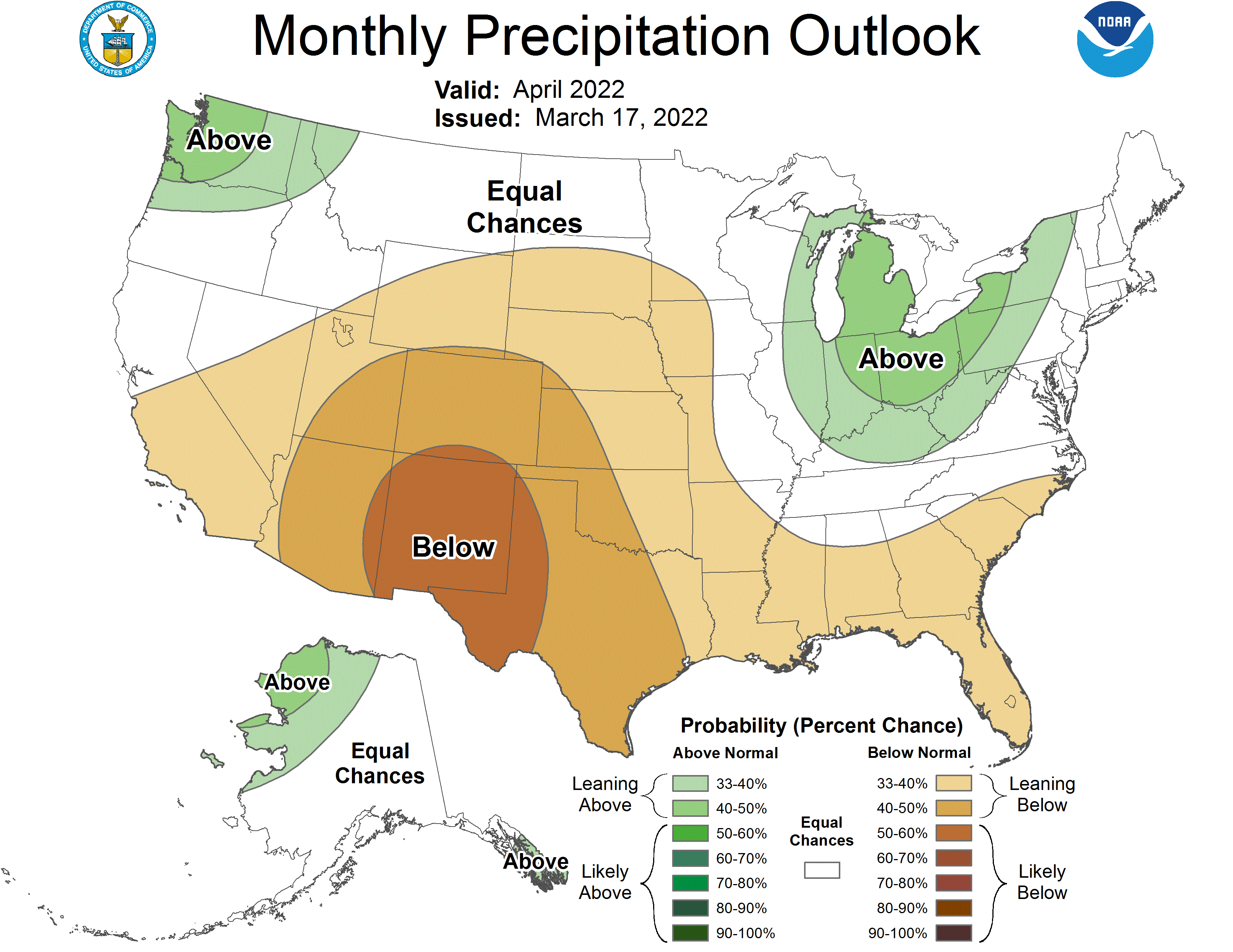
For the Pacific Northwest, La Nina has a similar impact during the spring as it does during the winter, with odds slightly favoring cooler and wetter-than-average weather compared to normal due to enhanced troughing in the Northeast Pacific. Indeed, the Climate Prediction Center is forecasting cooler and wetter-than-average conditions for Western Washington for April.
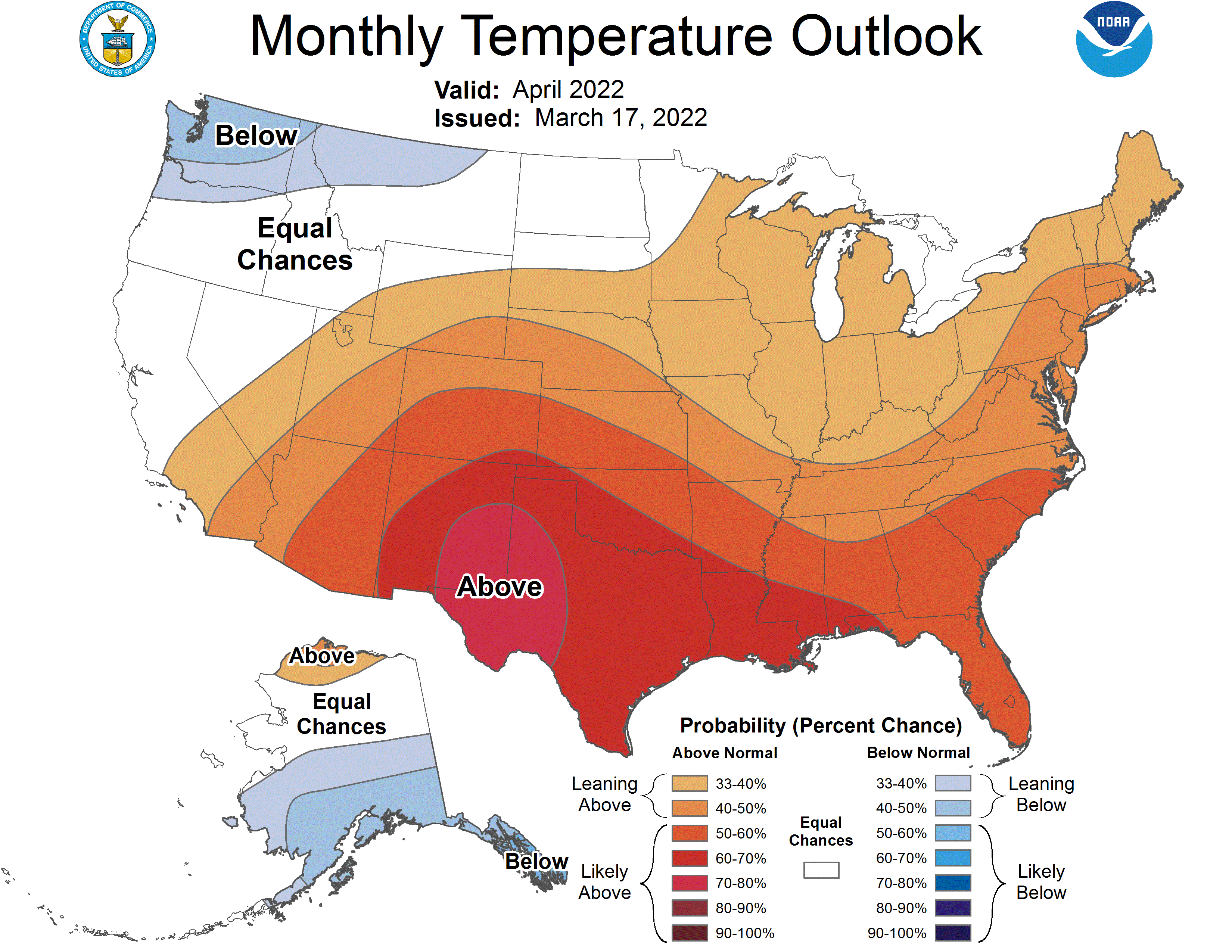
However, spring in the Pacific Northwest is, in many ways, just a calmer, warmer, and less depressing version of winter. Spring doesn’t have any common weather features that are *notably* distinct from winter, so it’s only natural that La Nina would impact the winter and spring climates in a similar fashion.
La Nina and Tornadoes
Other parts of the country have far more pronounced seasonal swings in climate, and as a result, La Ninas have different impacts to climate depending on the time of year they occur in. For example, La Ninas often bring more tornadoes to the US during the spring than Neutral or El Nino years due to the tendency for La Ninas to create a more robust storm track from the Southern Plains northeast to the Ohio River Valley. In the spring, systems that develop along this storm track tap into increasingly warm, moist air from the Gulf of Mexico to create thunderstorms, and the wind shear at different levels of the atmosphere between the southerly winds at the surface from the Gulf of Mexico and the westerly jet stream aloft causes these thunderstorms to rotate, occasionally spawning tornadoes in the process.
The below graph shows the confirmed tornadoes over the US from Mar-May 1950-2020, with the different colors corresponding to the El Nino/Southern Oscillation (ENSO) phase that year. The increasing trend in tornado counts is due to our increasing observational capabilities. Data is inconclusive regarding a link between climate change and tornado intensity/frequency.

Going back to 1950, strong La Ninas indeed have the greatest average number of tornadoes per year, with both of the “Super Outbreaks” of April 1974 and April 2011 occurring during strong La Nina years. At first glance, it appears that ‘very strong El Nino’ years have a high amount of tornadoes, but those years (1983, 1998, and 2016) all occurred relatively recently and aren’t particularly anomalous within their respective periods. All years exhibit significant year-to-year variability in tornado counts, regardless of ENSO phase. A blog I wrote back in May 2011 chronicles the major events of the 2011 tornado season. Between the April 14-16 outbreak, the April 25th-28th “Super Outbreak,” and the Joplin EF-5 Tornado on 5/22, it was a season for the record books, and hopefully one that will not be repeated for a very long time.
The attached map shows the 500mb height anomalies during the Mar-Apr-May time period for all strong La Ninas since 1950. Note the enhanced troughing over the Northern US, the enhanced ridging over the Southeast, and the stronger-than-average storm track from the Southern Plains northeast to the Ohio River Valley. This results in three things that favor tornado formation: (1) A favorable, large-scale dynamic environment for storm intensification, (2) favorable wind shear profiles for the development of rotating, supercell thunderstorms with warm, moist southerly winds at the surface and strong WNW winds aloft, and (3) ample instability due to the influx of Gulf moisture at the surface and much cooler air aloft.

The bottom line? Odds ***slightly*** favor a more active-than-usual spring for tornadoes with an above-average chance of a truly major outbreak like 1974 or 2011, particularly in the more tornado-prone zones east of the Mississippi. However, it is very hard to know given how much year-to-year variability we experience regardless of ENSO phase.
Our short-range tornado forecasts nowadays are quite good. We have advanced tools like doppler radar to pinpoint areas of rotation within thunderstorms that may spin up a tornado, and models are quite good at forecasting severe weather outbreaks. The main area for improvement is forecast communication – both making sure communities are aware of the tornado threat and that they trust and heed the warnings given by authorities.
The Long Range Outlook
Right now, most forecasts show us transitioning back to a “Neutral” phase next winter, but long-range forecasts are generally quite poor this time of the year, as the atmosphere is in flux due to the change in seasons and La Nina is weakening. By June, ENSO forecasts for the upcoming winter have much higher confidence. This phenomenon is known as the “springtime predictability barrier,” and I touched on it in a blog I published in April 2017 speculating whether an El Nino may return for the 2017-2018 winter. As fate would have it, we saw a La Nina that winter instead!

A third consecutive La Nina would not be unprecedented, but it is unlikely – since 1950, we’ve only had two instances of “three-peat” La Nina winters, and both occurred after major El Nino events (our current string of La Ninas did not).
In the meantime, our odds favor a cool and cloudy spring, so be sure to get out and enjoy the sunshine when it makes an appearance!