Tuesday, March 15 2011
12:31 P.M.
I’m actually writing this blog from school right now on Microsoft Word. I can’t actually go through to Blogspot and update it from school, but I think this will do since I can just copy this and put it up when I get home.
First, I want to talk about that windstorm we had on March 10th. I actually pointed out a strong storm in my last forecast that was slated for the 10th (remarkable timing for so long out!) but it came closer than was forecast in that model. It wasn’t that strong, but it followed a near perfect track for giving us strong winds. It rode up the coast, kind of like one of our classic “Sou’westers,” except it had more of a western than southern origin and followed more of a northeast track as opposed to a north-northeast track. Still, it eventually cut right across the Olympic Peninsula and came very close, which, combined with strong southerly upper-level air flow (when I say southerly, that means it originates from the south) and a compact pressure gradient, gave us surprisingly strong winds from a storm that is relatively small by northwest standards.
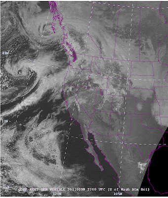
This picture shows the 2 P.M. visible satellite shot from March 9th. You can see two storms. One is by the Queen Charlotte Islands, and another is offshore southest of the 45N 135W line. Both storms have beautiful bent-back occlustions. Normally, this is a sign of a storm that has reached maturity and is starting to weaken. However, that is not true with our more southern buddy. This guy is just getting started. There is a localized low center, but it gets another burst as it runs into the moisture plume that is heading towards Oregon and interacts with a strong jet stream.
I would use a visible satellite as this storm seems to be shaping up better there, but this was taken at 6 P.M. at night, and there is no light to allow you to see. Therefore, a visible satellite won’t work! As you can see, the storm is developing a much larger occlusion. But as this next picture shows, the visible satellite is a very valuable tool for giving us very close-up details of storms.
This, taken at 10:30 on Thursday (the 10th) shows the storm closing in. It isn’t the clearest picture, but you can see the dryish slot offshore. The bent-back occlusion is to the west of that. But this next one is a little clearer.
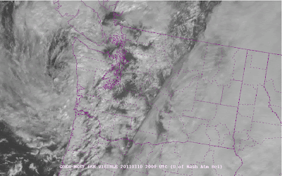
This one was taken at 12 P.M., 90 minutes later. You can see a “comma” if you look closely. This is a sign that a storm is rapidly developing.
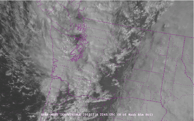
And at 2:45 P.M., 165 minutes later, the storm has crossed the Olympics. The mountains tear the form apart a little bit but we still get very strong winds when this occurs. And we did!
Today, we saw some thundershowers as a cold and unstable air mass passed over the area. We will probably see the same deal tomorrow and the rest of the week before drying down a bit for the weekend. Some more systems will return next week.
And I will talk about the tragic Japan earthquake and tsunami in my next post. One thing is for sure though… we NEED nuclear power. I really hope all this stuff doesn’t scare the world. Just don’t build nuclear power plants in earthquake-prone areas. But nuclear power is really the only feasible clean energy source that will work for the world for ages to come.
Your reading of this blog makes a contribution to my future. Thank you! Have a good one.
Charlie


