Thursday, January 19, 2012
11:06 A.M.
As if snow wasn’t bad enough…
After the major snowstorm yesterday, another storm was forecast, but precipitation was only supposed to make it to Olympia. The models turned out being wrong with this storm, and precipitation is located all the way to the eastern entrance to the Strait of Juan De Fuca.
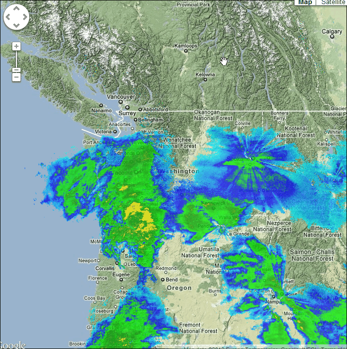
The upper atmosphere has warmed up significantly since yesterday morning, particularly south of Seattle, yet the lower atmosphere has largely remained below freezing. This type of setup can create freezing rain, which is more disruptive and hazardous to the region than snow. Snow can make the roads very slick, but freezing rain turns them into an ice rink.
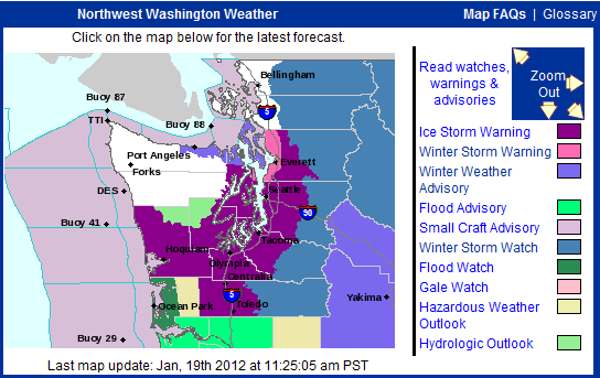
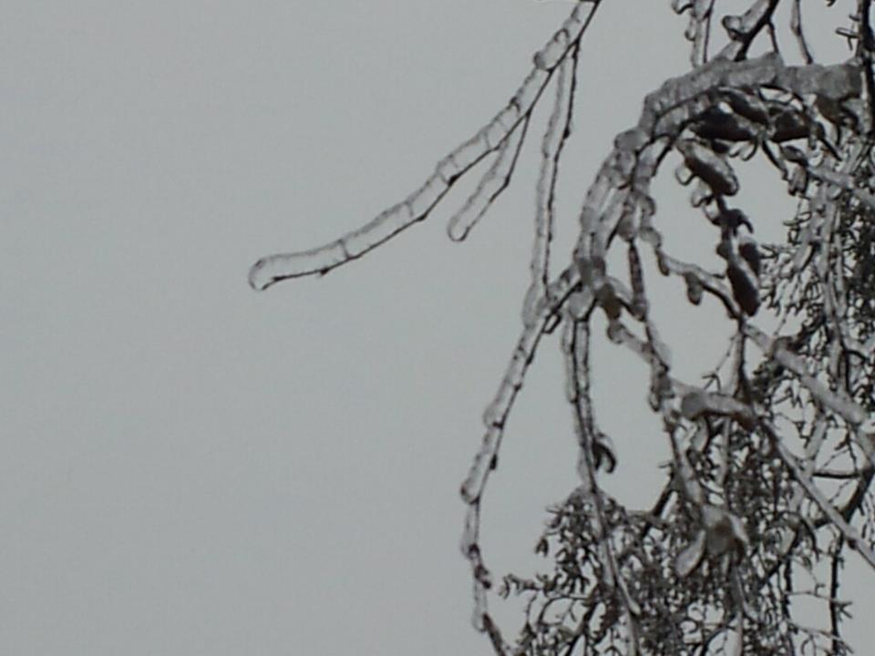
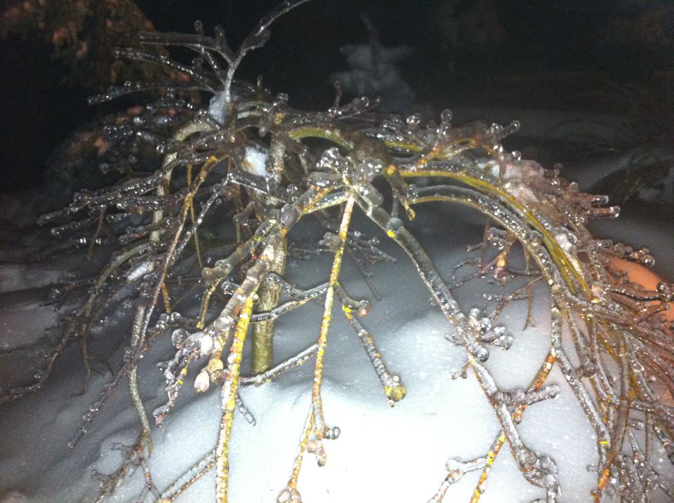
Many places south of Seattle are reporting freezing rain right now, and the NWS has issued an ice storm morning for much of the Puget Sound region and southwestern Washington. This is the first ice storm warning issued since 1996, where Seattle got 2 feet of snow before everything first changed to freezing rain, and then rain. While this storm is not expected to have as much of an impact on the region as the December 1996 one, it will be very disruptive to the region. Ice not only creates slick roads, it accumulates on trees and power lines, bringing them down and causing power outages. Many places have reported over a half-inch of ice so far. Let’s take a look at some pictures from around the region!


1 Comment
thanks for sharing.