Tuesday, December 12, 2013
11:13 a.m.
I’m back! Sorry it’s been so long. The end of the quarter was quite stressful. Heck, I had a seizure on the night of my final. That sure threw a wrench in my studying/sleeping plans. But, I survived, and that’s what really matters. Food. Water. Shelter. Survival.
And when it comes to weather, let’s face it; the only thing that REALLY matters to us around here is snow. We pretend to be fascinated by windstorms and floods, and I would say that we actually are interested in them, but nowhere near the extent as snow. And when it comes to snow, it’s only REALLY worth it if we get an arctic blast that makes the roads icy for days on end (though this was much more applicable when I was in school). I remember in 2008 when all of Seattle was covered in snow, and I skied down Madrona and Alder Hills. Alder Hill was actually pretty steep… I was going really fast… and since this was at night and much of the road is covered by trees, there were times when I couldn’t see anything, which was awesome and nerve-racking. I had also been watching a whole bunch of Warren Miller skiing videos lately, and I got the bright idea to ski down a steep hill of blackberry bushes across the street from my house. I survived with only a few minor scratches. Good times, good times.
Our last arctic outbreak was definitely our chance to get some snow, and considering how cold it got, the snow would have stuck around for a while. It’s a shame we didn’t get any. Thankfully, all hope is NOT lost, as some snow looks to be in our possible future for Friday!
 |
| Valid 04:00 pm PST, Fri 20 Dec 2013 – 84hr Fcst: http://www.atmos.washington.edu/~ovens/wxloop.cgi?mm5d3_ww_snow24+///3 |
Now, as you can see, this isn’t going to be the storm of the century, or even the decade. Earlier models had the highest amounts over the North Interior, but this morning’s latest UW WRF-GFS model has the highest amounts over the Kitsap Peninsula. This period of snow is not embedded in an arctic outbreak, so I regret to say it won’t be sticking around, but it should make for some G-Rated fun anyway, if you know what I mean. When a blizzard is around, don’t take the kids, grandparents, or even Navy SEALS outside. Leave that task to me and my camera crew.
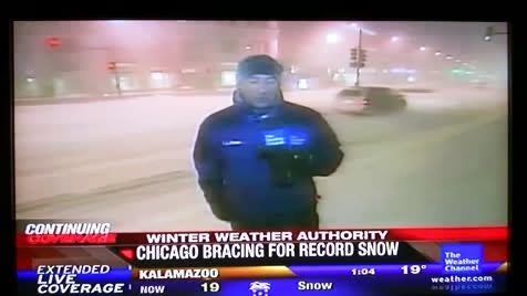 |
| Jim Cantore covering a winter storm in Chicago. He gets surprised by thundersnow – watch the video here! http://www.metatube.com/en/videos/48757/Jim-Cantore-Thunder-Snow/ |
By the way, if I ever become a TV meteorologist, I am SO doing the whole Jim Cantore gig. Getting paid to go to where the severe weather is? Sounds good to me. Unfortunately, The Weather Channel is stationed in Atlanta, meaning I’d have to give up skiing.
In the meantime, we won’t have any record thundersnows, but we should be on the lookout for perhaps a slushy half-inch or so. I made a scale way back in high school called the LAWES (Likelihood of an Arctic Weather Event With Snow) Scale that I didn’t get to use at ALL last year, so here’s a recap of the scale and my rating for the upcoming event. I usually don’t pull out this scale for these minuscule snow events like the one we may see where there is nothing arctic about them, but I’ve been dying to use it, so let’s go ahead and put this bad boy to work. I was taking a look at it a while back and decided it could use some revision. So revise I shall.
Here’s what the old scale looked like.
LAWES Level 0: You are on a planet that has the ingredients necessary for snow.
LAWES Level 1: Models are hinting a chance of snow beyond a week out, 0-20% chance of snow
LAWES Level 2: Models are showing a chance of snow within a week, 20-40% chance of snow
LAWES Level 3: Models are showing a scenario that would produce snow within 5 days, 40-60% chance of snow
LAWES Level 4: Models are in consensus about a snow event 1-3 days out, 60-80% chance of snow
LAWES Level 5: Places around the area are already getting snow AND snow is forecast for Seattle, 80-99% chance of snow
LAWES Level 6: Snow is occurring, 100% of of snow (derp)
>
Ending in:
.0 – the event is too far out to pin down snow totals
.1 – up to 2 inches of snow
.2 – up to 4 inches of snow
.3 – 2-6 inches of snow
.4 – 4-8 inches of snow
.5 – 6-12 inches of snow
.6 – board the next plane to Panama
____________________________________________________________
The second part of the scale is fine, but it’s the first part that needs an overhaul. There isn’t a direct correlation between how far in the future the snow event is forecast to occur and the probability of it occurring in the first place. Heck, sometimes, we look outside, see the white stuff, and sit back, bewildered, and try to remember if we even expected the white stuff in the first place. Therefore, I propose we drop the probabilities from the first number and add an alphabetical suffix to the second number while keeping the second number the same. Here are those suffixes.
a – very little consistent model consensus
b – one model consistent
c – two models consistent
d – three or more models consistent
*Keep in mind that I don’t have access to all the world’s models. That would be nice if I did. There may be other models I’m not counting that are showing snow events that would hypothetically “increase” the alphabetical suffixes.
You noticed that I didn’t put any probabilities in. I’m going to put the probabilities on a case-by-case basis, because all snow events, just like all people, and just like all snowflakes for that matter, are all special.
This applies to operationals and ensembles, and either one can work. For example, if the GFS operational model is inconsistent but the ensemble mean is consistent, then we count the GFS as consistent. If the operational was consistent but the ensembles were inconsistent, we’d still count the GFS as consistent.
So that’s the new and improved LAWES scale!
LAWES Level 0: You are on a planet that has the ingredients necessary for snow.
LAWES Level 1: Models are hinting a chance of snow beyond a week out
LAWES Level 2: Models are showing a chance of snow within a week
LAWES Level 3: Models are showing a scenario that would produce snow within 5 days
LAWES Level 4: Models are in consensus about a snow event 1-3 days out
LAWES Level 5: Places around the area are already getting snow AND snow is forecast for Seattle
LAWES Level 6: Snow is occurring
Ending in:
.0 – the event is too far out to pin down snow totals
.1 – up to 2 inches of snow
.2 – up to 4 inches of snow
.3 – 2-6 inches of snow
.4 – 4-8 inches of snow
.5 – 6-12 inches of snow
.6 – board the next plane to Panama
With suffix of
a – very little consistent model consensus
b – one model consistent
c – two models consistent
d – three or more models consistent
*I don’t have access to all models
Ladies and gentlemen, I give our chance of snow on Friday a LAWES 4.1b. However, I’m honestly not overly keen on it actually happening. Temperatures are going to be just above freezing in most places, and how cold will probably be decided by the extent of radiational cooling earlier that evening. I’m giving a 20% chance here for all you UW kids, but for those of you on Queen Anne or Capitol Hills, I’m giving you a 40% chance. Those to the north have a better shot, and those on the Kitsap Peninsula are above the 50% bar in my book. These percentages will change as the event comes closer.
One thing is for sure though. Those New England folks, who have been pummeled by feet of snow in recent days, think we are absolute wimps. So please keep this whole snow thing on the DL, and for once, don’t share this blog with your friends. When it comes to freaking out about snow… being a Seattlite is downright embarrassing.
Happy holidays!
Charlie

