One of my recent posts talked about how the transition to winter is quicker than the transition to spring. Though the post was concerned with temperature changes and had a global perspective, we in the Pacific Northwest tend to experience a particularly rapid pattern change as our summertime Eastern Pacific high disintegrates and strong zonal flow enters the area. And this coming week will be a textbook example of just how fast that change can be.
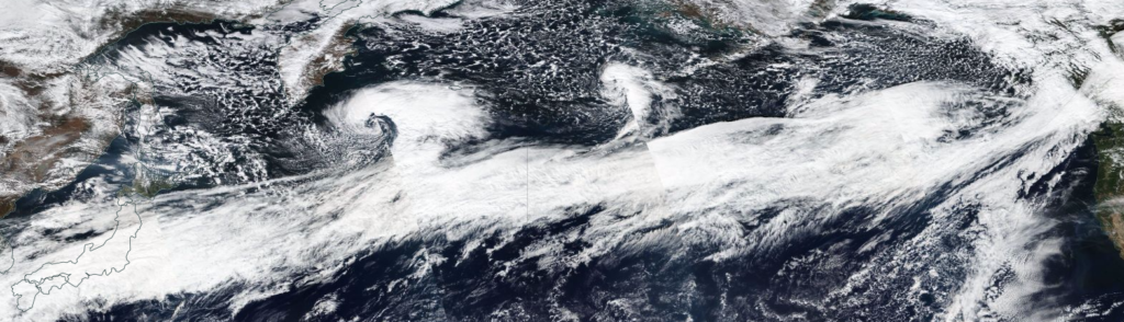
A very strong, 165+ knot jet stream is currently racing across the Western Pacific eastward into Southern British Columbia. Although it weakens as it approaches the Pacific Northwest and will initially be centered to our north, it will still be strong enough to spin up some strong storms and give the Pacific Northwest its first true taste of storm season.

Credit: NASA Worldview
One of my favorite things to do when we have such a strong jet stream is to take a look at the flight paths across the Pacific. Normally, flights take the “Great Circle Route,” which is the closest distance between two points on a sphere. But when there is a strong tailwind, pilots will often ride the jet stream across the Pacific, saving gas and time even though they are traveling a greater distance. Compare the Seattle to Tokyo and Tokyo to Seattle flight paths below see if you can guess which one is which without looking at the captions!


Our first system of the week is a weak cold front that will pass through Tuesday afternoon. Because the jet stream is centered further north, Southern British Columbia will take the biggest hit from this storm, while Portland will just get a couple hours of light rain in the afternoon.
I’m more keen on a strong warm front slated for Wednesday morning that will usher in a stream of strong, warm, and moist southwesterly flow through the day on Wednesday.

That, my friend, is an atmospheric river pointed right at the Pacific Northwest. It’s been a LONG time since I’ve used the word “atmospheric river” in a blog, and it feels immensely satisfying to type it again!
Atmospheric rivers are long, relatively narrow streams of moisture from the subtropics into the midlatitudes and are responsible for a staggering 90-95% of all meridional water vapor transport to them (Zhu and Newell 1998 , found via presentation by F. Martin Ralph, Ph.D). The image below shows the precipitable water (amount of liquid water you would have if all the water vapor in a column of the atmosphere was condensed into liquid) of the last 72 hours. In addition to the giant atmospheric river in the Northern Pacific, you can see Hurricane Ophelia barreling towards Ireland, which made landfall as an extratropical storm with hurricane-force winds that reached 118 mph at Fastnet Rock on the southern tip of Ireland.

Credit: University of Wisconsin
Western Washington will feel the brunt of this system, so Portland will escape relatively unscathed. The Olympics and Northern Cascades will get hammered, with 24-hour rainfall totals reaching 5-10 inches in spots. Because river levels are so low, flooding looks unlikely for most rivers. The Skokomish in Mason County has the best chance of seeing some minor flooding, but even that appears unlikely at this point.

Credit: University of Washington Atmospheric Sciences Department
Both Washington and Oregon will have a soggy Thursday as the cold front with this system pushes through. We’ll also have frequent showers in the cool, post frontal flow Thursday afternoon through Friday.
But the REAL fun comes next Saturday as an even stronger atmospheric river slams into the area. Current models have this river aimed directly at NW Oregon/SW Washington, and with river levels already high from the previous storms this week, we could be talking about minor to even moderate flooding on a few of the rivers across the area. There is still significant model disagreement – the EURO is much more robust with this system than the GFS, but as you can see below, the GFS is no slouch.

To recap: we’ll have a weak front on Tuesday, a strong warm front and atmospheric river on Wednesday (but with most of its energy directed north into Washington), a wet and unsettled Thursday as the associated cold front passes through and we see post-frontal showers, more showers Friday, and an even stronger atmospheric river on Saturday, with the potential for minor flooding. We calm down next week as a ridge builds over the area, but with November fast-approaching, I wouldn’t expect any tranquil weather to last more than a week.
Have a great week!
Charlie


2 Comments
Looking forward to getting some real weather as we move into the stormy season! I bought these rain gauges for a reason 😉
I love the rain… it was great to hear it last night while falling asleep. Rainfall totals are looking very impressive for the weekend… latest WRF gives us between 2.5 and 5 inches in 48 hours, with the potential for more than 10 inches by Mt. Hood.