
Our first day of storm chasing was more of a travel day than anything else, so it was icing on the cake that we were treated to some strong storms and spectacular lightning at night. We all decided to meet in Albuquerque, and although Albuquerque is hardly known for its tornadoes, it ended up being a pretty darn convenient place for us to meet. Chris drove from Phoenix, so we didn’t want him to drive all the way to some place like Oklahoma City when the storms were actually in Eastern Colorado. We’re doing enough driving already… the last thing we want to do is backtrack!
I was coming off an 84-hour week of night shifts with my job at Avangrid, and though I was naturally exhausted after I got after my shift was over at 6:30 am, I still had some last-minute weather model work to do before my 9:30 AM flight. I boke (past-tense for bike) home and quickly edited my weather model charts to add a domain covering the Great Plains. To my amazement, I was actually able to get everything working within 20 minutes AND not forget anything at home, both of which are very rare events by themselves. I got to the airport at 8 AM in plenty of time to catch my flight.
After getting into Albuquerque just after 1 pm, I called Joey and Chris, who were at a nearby Starbucks and picked me up a few minutes later. We were on the freeway heading east towards Tornado Alley by 1:30 pm. Running on no sleep, I was about as sharp as a rotten baby carrot… I remember seeing a train go buy and trying to explain torque vs horsepower (which I already don’t know well) and just trailing off mid-sentence and not giving a care in the world.
The forecast for Monday called for an “enhanced” risk of severe thunderstorms stretching from Colorado all the way southwest to the Oklahoma Panhandle/Texas border. Our initial target was Liberal, Kansas, but seeing as we weren’t expected to get there until 8 pm or so, we decided to keep our eye on a few storms that were developing in less-favorable but closer environments to the south. A few storms started firing up in the Texas Panhandle area, so we decided to pull off and chase one slightly northeast of Dalhart, Texas, along I-87 that looked particularly robust. This storm eventually garnered a severe thunderstorm warning for 60 mph winds and 1-1.25 inch hail, and we took some nice pictures of the storm.
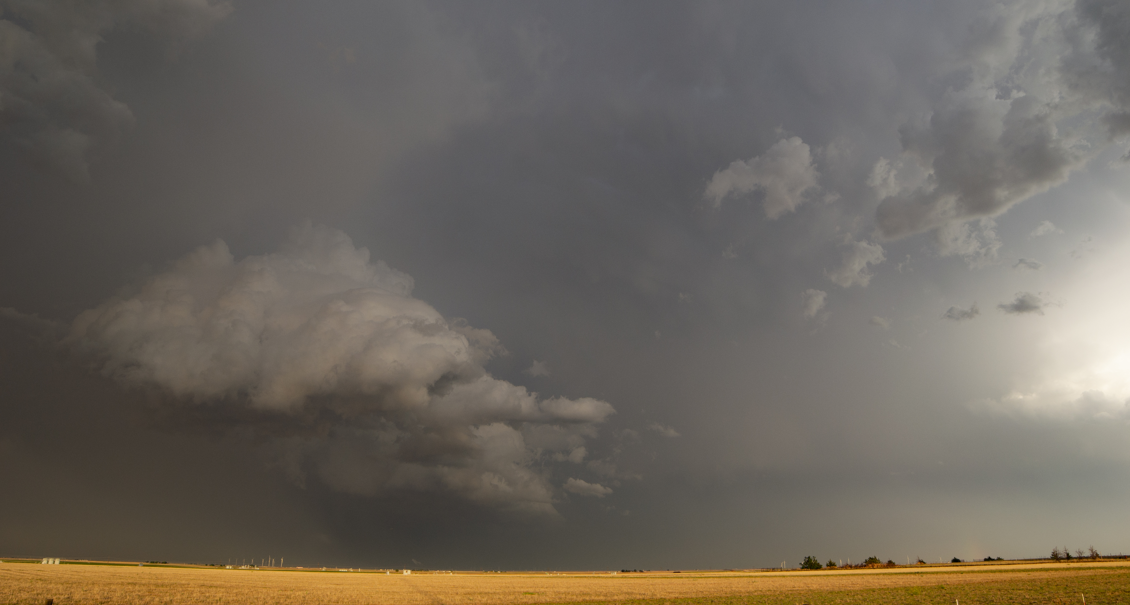

The storms themselves grew extremely explosively and were tilted sideways, which is a sign of strong vertical wind shear. Wind shear is important because it helps create a rotating air column, which can then be titled upright by a strong updraft and in the process take the form of a rotating updraft (known as a mesocyclone) that supplies warm, moist air into the thunderstorm. A tornado is simply an intense extension of this rotating updraft down to the surface. Strong wind shear also helps separate the updraft and downdraft, preventing the downdraft from raining into and choking off the updraft, and it also makes it much more difficult for weaker storms to form and suck up the energy around stronger storms, as these weaker storms simply get torn apart by the strong vertical shear.

These storms were tracking northeast at a good clip (I’d estimate 30 mph), so we just paralleled them along I-87 and headed towards more favorable storm formation conditions in the process. We stopped a little north of Goodwell, Oklahoma to take another look at this storm and saw multiple cloud-to-ground lightning strikes all around us, so we promptly headed back in the car. A funnel cloud was spotted near Gruver, Texas, so we set our sights on this storm and tried to go catch it.
Getting to this storm was a real chore. We had to “thread the needle” through the passing supercell we were on and the incoming Gruver supercell, so we continued NE along I-87 to Guymon, OK and then turned east. We did a pretty good job of avoiding the heaviest precipitation from the quickly-approaching Gruver storm, and although it lost its tornado warning by the time we were on it, Chris was still able to get some fabulous pictures of lightning just north of Perryton along Texas/Oklahoma border on a side-road going through a wind farm.


Photo Credit: Chris Scragg
We ended up staying in the Budget Inn in Perryton, Texas for the night, and Joey and I got some much needed rest. But Chris, bless his heart, decided to take one for the team and sleep on the floor, as there were only two full-sized beds. And as another tornado-warned storm swung through the area in the evening, Chris decided to take a walk around Perryton and get some more spectacular lightning photos.

I’m finishing this post up at 3:10 pm Central Daylight Time as we sit in the “Good to Go” Coffee Shop on Woodward, OK. Storms are firing up as I type, so I gotta go. I’ll catch you cats tomorrow!
Charlie

2 Comments
Awesome write-up and photos!! Glad you got to experience some good weather the first day out. Looking forward to your experiences in the days ahead.
Thanks Jeff! Yeah we’ve had some amazing experiences thus far… our second day (I got the blog up last night) was out best with multiple giant mesocyclones, and our third day had plenty of gust fronts and was also pretty spectacular. Yesterday was just a day of driving but today should also feature some strong straight-line winds… perhaps a tornado if we are really lucky.